After writing up the results of all the simulations in our validation report, the USEPE partners thought that more could be done to investigate the use of high-speed corridors.
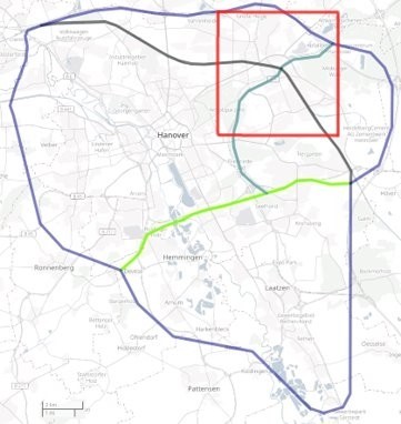
So, they decided to do another round of simulations, even if this wouldn’t go into any report, in a new area centered on a point where 2 corridors intersect:
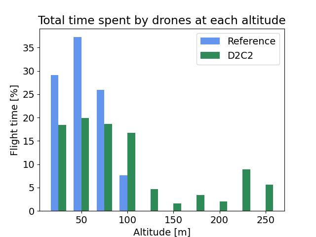
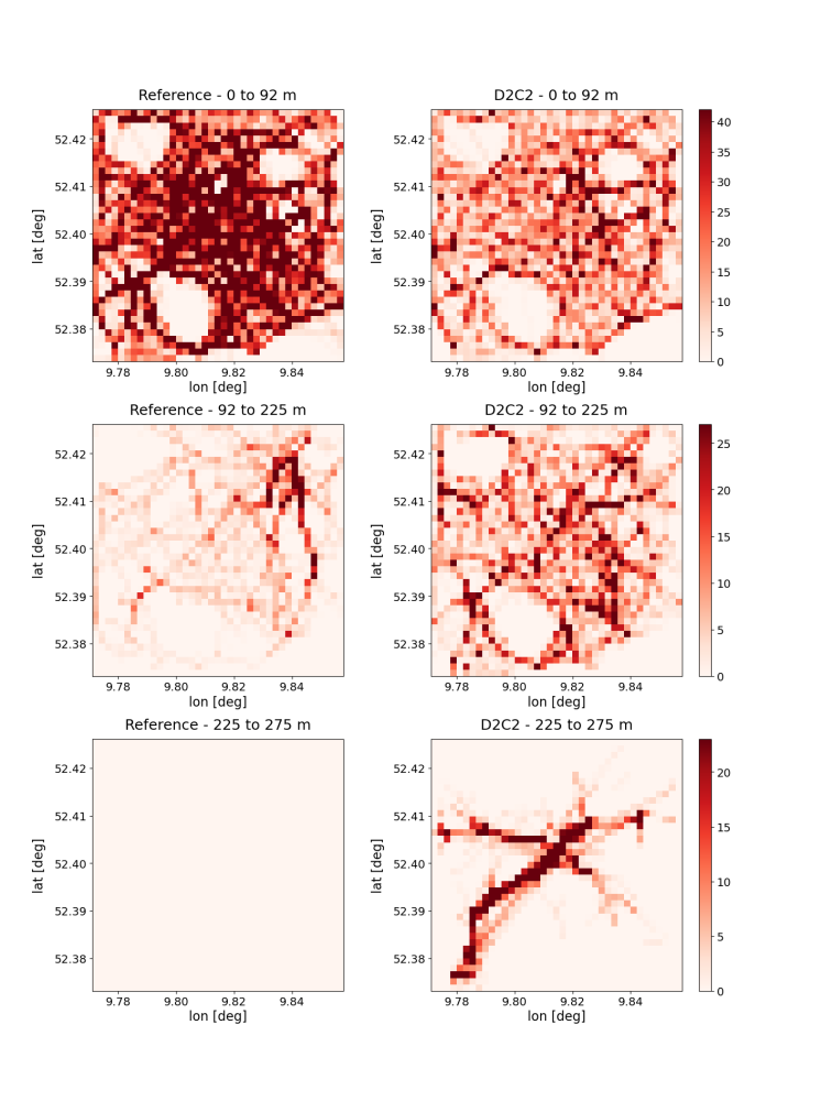
The simulation ran for 30 minutes, with datasets for low, medium and high density, and with only point-to-point traffic (background traffic in previous simulations). This was called Exercise 4.
The results were quite positive. First of all, D2-C2 performs really well when it can fully manage all aircraft and there are no abnormal types of flights, such as surveillance or emergency.
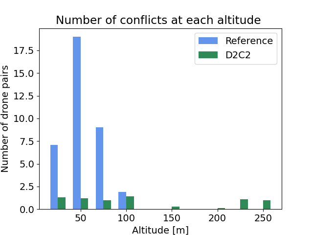
Second, the corridors were actually being used when they appropriately covered the area, as the following bar graph and heatmaps of the traffic distribution at different altitudes show.
All the data from the simulations can be found on GitHub: https://github.com/USEPE-SesarJU/scenarios
Specifically,The log files are here: https://github.com/USEPE-SesarJU/scenarios/tree/main/exercise_4/output/
More figures are here: https://github.com/USEPE-SesarJU/scenarios/tree/main/analysis/figures/exe4